Zoran395: I am very interested with your Kornstadt, it looks great!
Actually I am not populating Leningrad so full than it is for ex. in FinsGulf map. This is a Finland vs. Russia Winter War and Continuation War map and Finland never attack against Lenigrad City. I am going to copy only the Leningrad's central town to this map from FinsGulf map. The rest Of Leningrad area is going to be textures with houses and factories here and there. There are also coming many historical grass and concrete Russian airfields around Leningrad: Kasimovo, Levashovo, Gorskaya, Komdatskoje, Pavlovo etc.
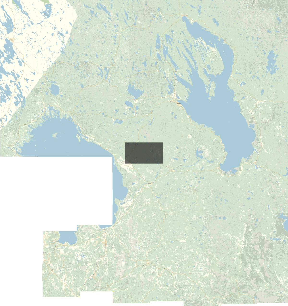
Kapteeni: I didn't use satellite data with the map-C file. I found a good Russian map and I composed a huge map (about 20 000 pixels X 16000 pixels) from screenshots with a good reasolution. The dark area in the middle of the map is ONE 1920 x 1080 screenie (this working picture is one year old):

The I use Photoshop and cut the blue waterways away and scale the final map to 11200 x 8320 pixels grayscale map_C-file. I was a huge job, let me say!

This is the high-class Russian map site. It is much more better and exact map than the Google Earth:
http://maps.yandex.ru/?ll=34.572889%2C62.132006&spn=6.569824%2C1.589311&z=8&l=mapThe 2800 X 2080 pixels grayscale map_H is made from the satellite data. I scaled the map_C's working version also to 2800 x 2080 pixels and adjusted the map_H just precise with the map_C with Photoshop's Tools: Scale, Skew, Perspective etc. So as you can see it needs a lot of Photoshop working. It has been my main application over 20 years in my daily work...

So this is not an update from an old Kapteeni's huge Karelia map, it is becoming a whole new map and it takes a time to finish it. But I think the first version is available on next winter. I am going to finish the Karelian Isthmus and Olonets Isthmust (in the middle of the map) to this version. After that I am going to concentrate the "edges" of the map...

 Author
Topic: Karelia - Finland vs. Russia 1939 - 1944 (Read 17000 times)


