Hey Guys,
Since there is no Map request section in the Map area , I thought I'd post this here.
If this violates any protocol please remove or redistribute as required.
As time goes on there is a more and more complete representation of mods available , and the realm of maps is no exception.
Because I enjoy IL2 much for the historical representations it offers , and I am interested specific to the WW2 era , I feel there
are still a couple of key geographic areas worthy of consideration by map makers out there.
Another priority in terms of what represents a utile map for IL2 ( for me) is heavily influenced by my interest and involvement in
SEOW (Scorched Earth Online War online cooperative campaigns for IL2). This usage has a few specific requisites for full
functionality , some of which are not always considered and therefore included in the maps available to IL2.
Mostly this is in terms of the perfect function of roads , railroads and bridges , but is also affected by mapmakers who
( for their own excellent reasons) enjoy creating beautiful heavily populated maps , and also more often by maps whose chosen
geographic areas sometimes fail to reflect the historical ground and sea war and the necessary supply routes ( and how they
shaped the air war) by exclusions of important areas beyond the map edges portrayed (sometimes so frustratingly close to the
edges that it seems inexplicable why they weren't included.
I make these statements not to raise the ire of the splendid mapmakers out there , but rather to illustrate what some of my criteria
for map usage are. Further , I make no claims to be able to make a map , and must make my contributions to the community in
other (limited) ways . Publicizing my thoughts is it seems to me the most useful ; even if support my ideas is not shared by others ,
then at least the publicizing of the thoughts can hopefully direct some modders energy onto a positive path for others.
I will list my thoughts as they exist in priority for me.
I will attempt to justify my prioritization .
Others will of course have differing opinions...
1) Lorraine - Saar - Vosges
My suggested edges of a useful map would be defined as :
Vouziers - upper left corner -
Mannheim - upper right corner -
~Bar-sur-Aube - lower left corner -
Villingen-Schweinnenger - lower right corner
Include Merzig - upper centre -
Colmar - lower centre -
Other towns it would be representational to include Speyer , Heidelberg , Pforzheim , Gambsheim

Historically this map is principally useful only for 1944-45 , but it does cover several important subcampaigns.
In order to cover the span of all these campaigns , I believe 3 versions would be necessary :
a grey wet autumn map , a light snow to represent the shoulder seasons both autumn and spring , and
a heavy snow winter map.
a. The September 1944 Battles in Lorraine. In fact these gnarly contests stretched into the late fall of '44.
Lots of ground-pounding here. Primarily the US 9th Tactical Air Force , and some significant Free French battles.
"Lorraine Campaign" is a term used by U.S. Army historians to describe operations of the U.S. Third Army in Lorraine during World War II from September 1 through December 18, 1944. Official U.S. Army campaign names for this period and location are Northern France and Rhineland. The term was popularized by the publication of a volume of the same name by the U.S. Army in 1950. As written by the volume's author:
Precise military terminology has been employed, except in those cases where clarity and economy of style have dictated usage of a more general nature. Thus, the Third Army operations in Lorraine are considered to be a "campaign" in the general sense of the term, despite the fact that the Department of the Army does not award a separate campaign star for these operations.
Although the term Lorraine Campaign is unofficial, it represents a more traditional use of the term "campaign" in that the battles described by the term were part of a larger operation that had a set goal. By contrast, the official U.S. Army campaign names refer to what were actually multiple campaigns and large military organizations with diverse goals.
Operationally, the term encompasses the assaults across the Moselle and Sauer Rivers, the battles of Metz and Nancy, and the push to the German frontier at the onset of December 1944.
The Lorraine Campaign consisted of three phases.
i.The push to the Moselle
The Third Army, lacking gasoline, was unable to swiftly take both Metz and Nancy, unlike the actions that characterized the rapid advance across France. After the battle of Arracourt following the fall of Nancy and the meeting engagement of Mairy, the Third Army had to pause and await resupply. For the OKW, stopping Patton was a priority that resulted in replacements and reinforcements for the German Fifth Panzer Army and First Army.
ii.Stalemate around Fortress Metz
Until 12 October 1944 and the beginning of the assault on Metz, exceptionally rainy weather hampered military operations. This combined with spirited German resistance and competent use of the terrain around Metz to delay the fall of Metz until late in November 1944.
iii.The advance to the Saar and the Siegfried Line
After the fall of Metz and its fortifications, the Third Army launched an offensive to advance to the Westwall. The attack across the Saar River was underway as the Germans opened the Ardennes Offensive. Operations on the Saar were scaled down as Third Army shifted troops north to counterattack the German offensive into Belgium and Luxembourg from the south. The move north of the Third Army marked the close of the Lorraine Campaign.
The 3rd Army sustained 55,182 combat casualties during the Lorraine Campaign (6,657 killed, 36,406 wounded, 12,119 missing).
Exact German losses in Lorraine are unknown, but were suspected to be severe. At least 75,000 German prisoners were captured by the 3rd Army during the offensive.
Offensive operations by the U.S. Army in this part of the Western Front resumed in mid-March 1945 with the objective of occupying the Saar-Palatinate.
b. Unternehmen Nordwind , the German subsidiary attack to Wacht am Rhein , carried out through the Vosges mountains in
atrocious deep snow conditions.
.jpg)
c. The Gambsheim counterattack

From "Riviera to the Rhine" :
Operation NORDWIND proved only the first in a series of German attacks against the 6th Army Group, which American soldiers dubbed collectively the New Year's Eve offensive. Altogether, between 5 and 25 January, the German Army undertook four additional multidivision offensives against the U.S. Seventh Army and another against the First French Army just above the Colmar Pocket. Although most of these attacks were hastily planned and executed with little finesse, some caught the Americans by surprise, and together they threatened to overwhelm the tired units of the Seventh Army. Having already been greatly weakened by the massive diversion of military supplies and replacements to the Ardennes, Patch's forces somehow had to find the means from their own strength and resources to turn back the multiple German threats.
On 5 January, as Patch began deploying the 103d Division east of the Vosges, Himmler's Army Group Oberrhein began its NORDWIND "supporting" attack."(1) Under the direction of General Otto von dem Bach's XIV SS Corps, the 553d Volksgrenadier Division, reinforced with armor and commando units, spearheaded the main effort, which fell on the right, or eastern, flank of Brooks' VI Corps across the west bank of the Rhine at Gambsheim, just ten miles north of Strasbourg. Two days later, on 7 January, Rasp's Nineteenth Army initiated another attack south of the city near Rhinau, on the northern edge of the Colmar Pocket. Code-named Operation SONNENWENDE ("Winter Solstice"), the southern offensive included attacks by Thumm's LXIV Corps, with the 198th Volksgrenadier Division, the 106th Panzer Brigade, and other armored elements (with forty to fifty heavy tanks and assault guns). The new series of attacks at Rhinau and Gambsheim not only threatened the southern flank and rear of the VI Corps, but also the city of Strasbourg. If Hitler could not take Antwerp in the north, then Himmler was determined to present him with Strasbourg in the south. The two attacks quickly forced Patch to shelve any plans for an offensive by the 103d Division in the Vosges or any expectations of immediate relief from the French in the south.
d. The German retreat to the Rhine River ; a continuous series of moving engagements from the Sarre to the Rhine.
Elements of this occurred in the Autumn of '44 , but following the defeats of the Ardennes and Nordwind , the Americans
drove the Germans east relentlessly in the early spring of '45. ((note : this could conceivably have a map of its own ,
situated further east than the one I am proposing here)).
2. Armee Gruppe Nord 1942-43
We have a map of Leningrad , and we have a brilliant map of Moscow (big thumbs up , Oknevas!), but the historically significant area
between them remains unrepresented.
There are many , many battles that can be represented on this map , and some of them are unique in what they offer to the IL2 gallery of
history.
In my mind the area this map needs to cover could be as contained as this example , but I would prefer it include some towns further east
such as Dubno , Klin and Rzhev ( I know Okneva's Battle of Moscow map includes Rzhev, but Rzhev and this region were intrinsically
linked regarding supply , transferring units, and airbases that were significant for both sides.
3 Versions to cover weather : Summer , Muddy Autumn , Winter.

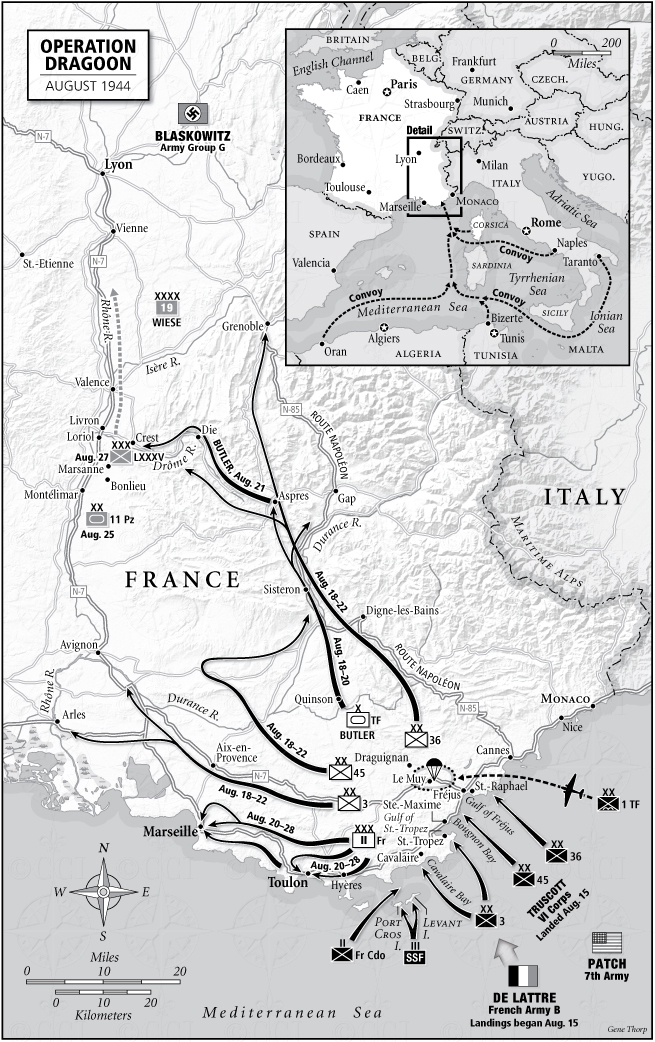
3. The Invasion of Southern France , Operations Anvil and Dragoon , August 1944.
This map would also be useful for USAAF strikes from Sardegna and Corsica on targets in Southern France in the Spring of 1944.
A bonus of this map is that it ties in directly to the south of the Lorraine - Saar - Vosges Map.


This Map would ideally go as far north as Lyon and Milan , but if necessary could be trimmed to have the north map edge at Avignon -
Grenoble - Turin. The map should include both Corsica and Sardegna in total , as well as Menorca.
I would suggest avoiding Rome simply to save the functionality of the map.
This is still a pretty big map, and I don't know how doable , given the heavy populating it might require.

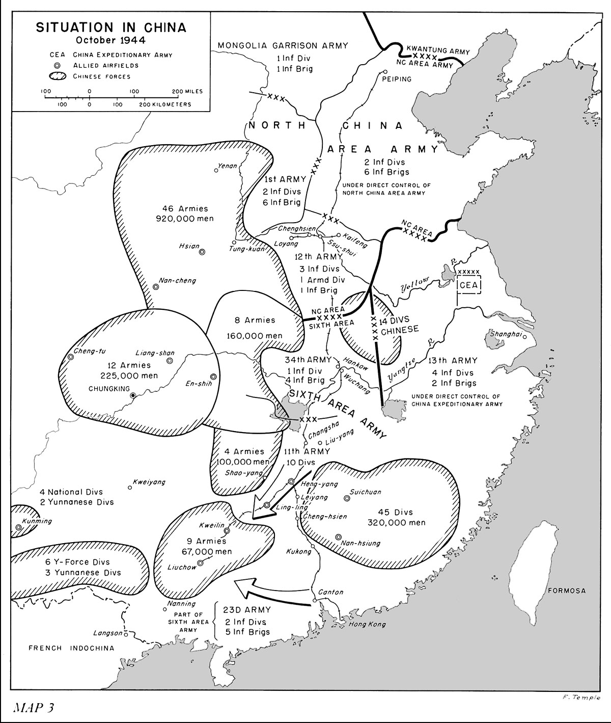
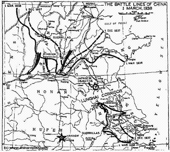
4. My last map idea for today is the Lower Yangtze River , including Shanghai , and as far upstream as map limitations allow. This would allow for some really interesting campaigns and missions in the 1932-1937 period.


Anyhow I hope these thoughts interest some and may sometime in the future inspire a map maker looking for their next project.
Sincerely,
Kopfdorfer