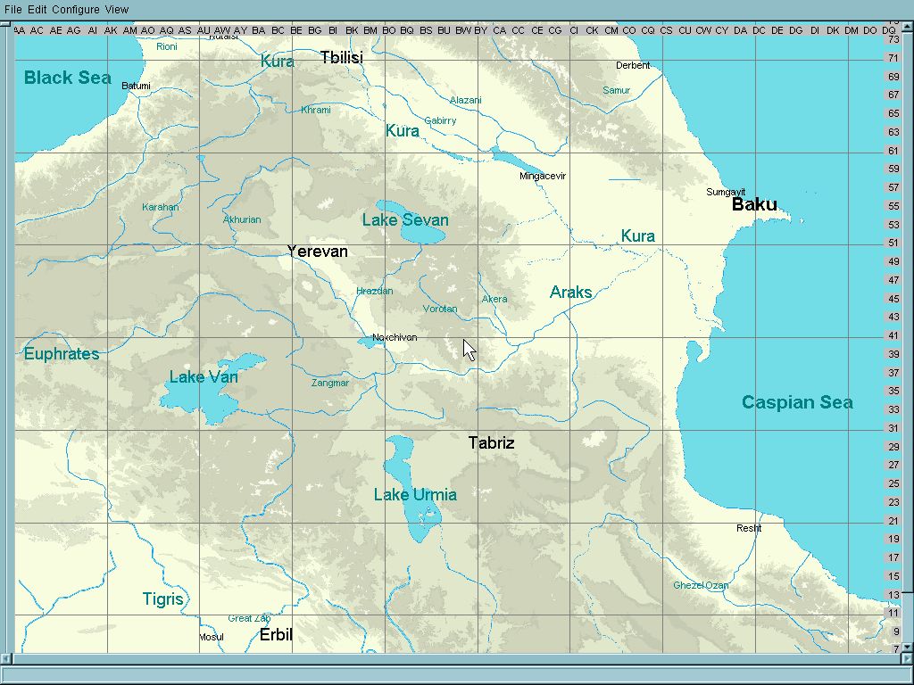
Upon the initiative of zloy (aka nachprod) the work on the area situated south of CzechTexan's map of Caucasus, from Tbilisi on the north to Erbil in the south is starting.

The area is very mountaineous , and moreover, it cotains large lakes positione far above the sea level.
In our beloved Il-2 Sturmovik, the rivers and lakes should be at sea level in order to allow both bridge positioning and ships traffic.
By bringing the lakes to sea level we are at risk to deform height map perhaps unacceptably,
while letting them at their narural height we must abandon the possibility of ship movement on them.
So I ask the community to help me what to decide of the two ways.
Any comments and proposals will be appreciated.
EDIT:Final version of the three maps, covering WWI, WWII and era of concrete airfields,
can be d/l here :
https://www.mediafire.com/file/kf0ytgr2rnk06w5/Zakavkazye_map_I%252C_II%252C_III.7z/fileCredits:
zloy, Skyfan, Toobone, Lexsey, andrey65, deSAD, ZRN395, Mixx, Vasya, Molva, Grejf11,
farang65, Dimlee, RealDarko, carsmaster, vonofterdingen, bomberkiller, Maro,
CzechTexan, Kelso, Mission bug, David Prosser, BlackStaff, I hope nobody forgotten.
 Author
Topic: Map of Transcaucasia (Read 22440 times)


