Special Aircraft Service

Please login or register.

Login with username, password and session length
Advanced search  
Pages: 1 [2]   Go Down

Author Topic: SOLVED: Searching for an unknown RAF airfield in GB during Operation Jubilee (Dieppe Raid)  (Read 3554 times)

0 Members and 1 Guest are viewing this topic.

Shessi

  • member
  • Offline Offline
  • Posts: 234

Hi W,
I really enjoy this sort of detective work, so fire away!  Let's have some fun....;)

Cheers

Shessi
Logged

Wa99el

  • member
  • Offline Offline
  • Posts: 50

I will surely have some new questions shortly. I still have a lot of research
to do. Now that I know that the airport is RAF Ford, I can start to
incorporate this RAF station into the North Sea map. To do this, I always
need a historical aerial photograph so that I know which runways the
airfield had, which taxi routes were on the airfield. Where were the
parking spaces and what buildings were there on the airfield.

Unfortunately I did not find an aerial photo for RAF Ford. Maybe the
digitized film rolls will help me further. What I found is a scale sketch
of the airfield. Better than nothing.


Since there may still be some buildings left today, I also look at Ford Airfield on a satellite image.


At first glance you can see that a lot has changed in Ford over the years.
Now I lay the sketch of the historical site over the satellite image, adjust it and then
I look at which buildings from that time still exist:


Almost all of the buildings from that time no longer exist. That may be a
little disappointing now, but I now have the position of the old buildings on
a current satellite image. I will be able to use this combination of satellite
image and sketch as a template for the airfield in the IL-2 flight sim.

Finally, a picture with the location of the airfield in the region of England.


The next step will be marking the pitches, which I use as spawn spots in IL-2.
Logged

Mission_bug

  • Modder
  • member
  • Offline Offline
  • Posts: 6072

From a research point of view it is now very difficult to find the old airfields as they were back then, because of the huge area a airfield covers many throughout the country have developed into industrial sites and even housing estates to take up the ever growing population density all over the nation but particularly so in the south as existing centres find a need to accommodate the over spill from the major conurbations. ;)

You can still find some of the houses as many were privately owned, sadly many farms merged into larger entities and old airfield buildings have either been knocked down or brought up to a more modern standard as small industrial enterprises so might not look quite as they did, you have a considerably task ahead of you Wa99el as these islands of ours are very densely populated for the area available, thankfully, much has been well documented, however, finding the specifics for your project can be difficult. :(

Museums are generally welcoming to researchers, however, many collections are housed in what were the old bases and usually getting permission to search through their records can be time consuming as most of it is kept within what is a working environment so requires special appointments to view what is available.

Good luck with this endeavour, the resulting map should be quite a treasure once complete, I admire your attention to detail. 8)


Wishing you all the very best, Pete. ;D
Logged

Wa99el

  • member
  • Offline Offline
  • Posts: 50

Yes. Things change over time. When building a map, you have to take this factor into account.
First of all, we have the limitations of the game. You can only work towards reality to a certain
degree. Nevertheless, I love Sturmovik because it has its own flair. Even if there are some flight
sims today that can surely tickle more reality.

On the subject of changing the building structure through time and change, I swung myself into
Google Street View and collected a few photos from RAF Ford.
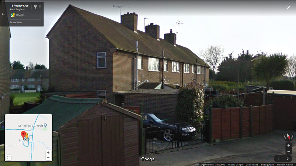


The first thing you notice: This car didn't exist in the 1940s  ;D Another point is the television antennas on the house.
The front gardens are also peppered with many things that were only added after the war.
The house, however, and all the other houses in the area were already there when the
Boston bombers flew to Dieppe in 1942 or later to the invasion area in 1944.

Now what I'm thinking: is there a building type in IL-2, which corresponds to
these houses. I think CanonUK (Joe) has brought some of these buildings into the Sim.
I will take a look later. Sometimes it also works if I copy the 3D structure from
an IL-2 house and then design my graphic skin for the building and insert it as
a new object in the object list.

Incidentally, the house is one of several houses northeast of the runways just
behind the airfield near St. Andrews Church. The street forms a kind of "C" with
the houses. This area is particularly important, since this area is the entry lane
of the airfield, as you can see in the film.

The next photo is from the same area:
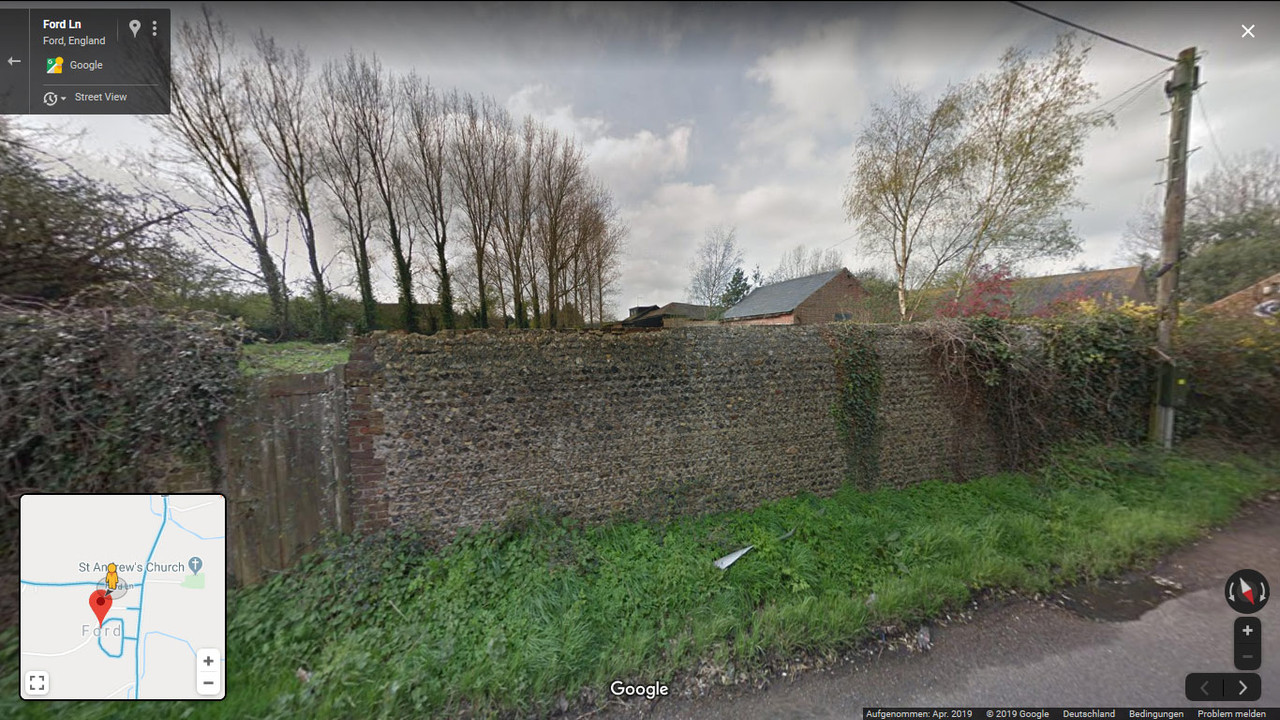


A beautiful old wall. I always have to restrain myself here. When I see
the old brick wall, I get the desire to insert exactly this wall into the game
with a high-resolution skin :-D behind it are some brick buildings, which
could have been a farm.
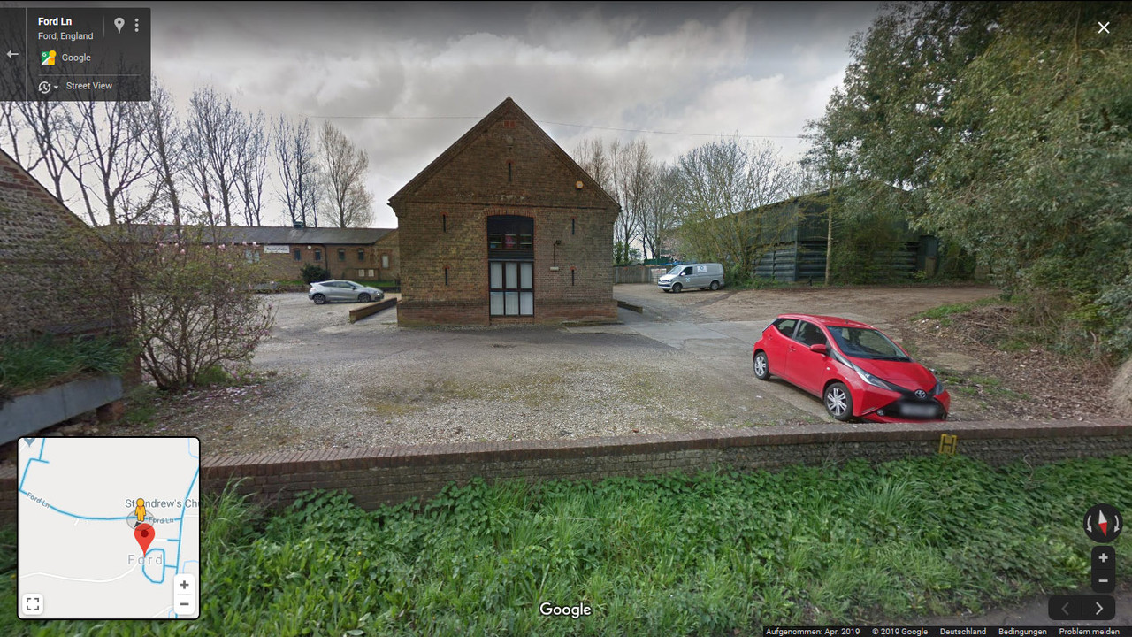


The buildings look like we already have them in the game. The old airfield
already begins south of these buildings. There are 3 so-called pens, which
look like an €. Their shape can be recognized very quickly. These buildings no
longer exist, but we already have such pens as objects in the game. I have
often seen them on the CanonUK map.

The time is over again. The next few days will be pretty Christmassy and I
won't have much time. I hope you all have a great Christmas time.

In this sense:

a blessed festival.


Logged

Unca-Fester

  • Graduate of the Dirk Gently School of mucking about.
  • Modder
  • member
  • Offline Offline
  • Posts: 197


This is a great thread,  I too had been researching lost WWI airfields.  Corcieux in Alsace.  The town center and old church building still exists.  Using old photos from Albin Denis's Ancient Aerodrome website, I was able to locate the field and place it in FlightGear's scenery, but could not make out the exact size and dimensions of the airfield.  Like so many old aerodromes from WWI, not all of them have aerial photos showing them and their surroundings and original road networks.

 Luckily for Corcieux there are several shots of the unique lead covered church belfry, with the aerodrome's buildings in the foreground.


Using the same technique I was also able to find Xaffevillieur's WWI RAF 100 squadron's old airfield where they flew their Handley Page O-400's out of, and the French night bombing squadrons of Esc. 108 at Vadelaincourt and Lemmes along the D1916 Sacre Vie road.

The advantage to FlightGear is the global metric latitude and longitude co-ordinates are used and can pretty much do a close approximation placement.  Plus FG has often times has the local secondary roads as shapefiles with differences in terrain boundaries.

I was able to place the Old Home Defense airfield for Stow Maries exactly because of the field is 'marked' in FG as a shapefile for cropland versus scrub and forest.


Logged

Gubi

  • Flying Ass Clown #34
  • Modder
  • member
  • Offline Offline
  • Posts: 1276
  • RIP

Where have you been Fester?  Holy Smoke...
Logged
I am a moron.

Unca-Fester

  • Graduate of the Dirk Gently School of mucking about.
  • Modder
  • member
  • Offline Offline
  • Posts: 197

Hi Gubi,  I've been busy with RL, I'm still simming.
Logged
Pages: 1 [2]   Go Up
 

Page created in 0.031 seconds with 24 queries.