Special Aircraft Service

Please login or register.

Login with username, password and session length
Advanced search  
Pages: [1] 2 3 4 5   Go Down

Author Topic: Central of Honshu 2017(Keihanshin megalopolis)  (Read 9763 times)

0 Members and 3 Guests are viewing this topic.

Ju87R

  • member
  • Offline Offline
  • Posts: 45
Central of Honshu 2017(Keihanshin megalopolis)
« on: July 27, 2020, 04:26:57 AM »

First of all, I am not an English speaker, so my English may be a little strange, I hope you will forgive me.
Nowadays, covid-19 is so popular that people can't travel around the world to take a vacation. But it doesn't matter. After I finish this map, you can go to the cultural centers of Japan, Nara, Kyoto, Osaka, and Kobe in IL-2 1946. More importantly, you can fly with your favorite fighter. What a wonderful thing! In this map, there are not only many airports that provide you with landing sites, but also very restored places of interest.
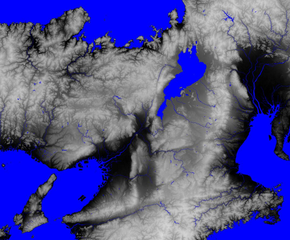
This is the whole range of the map. In the very west is Himeji, in the south is a corner of Shikoku Island, in the north is Wakasa Bay, and in the East is Nagoya.


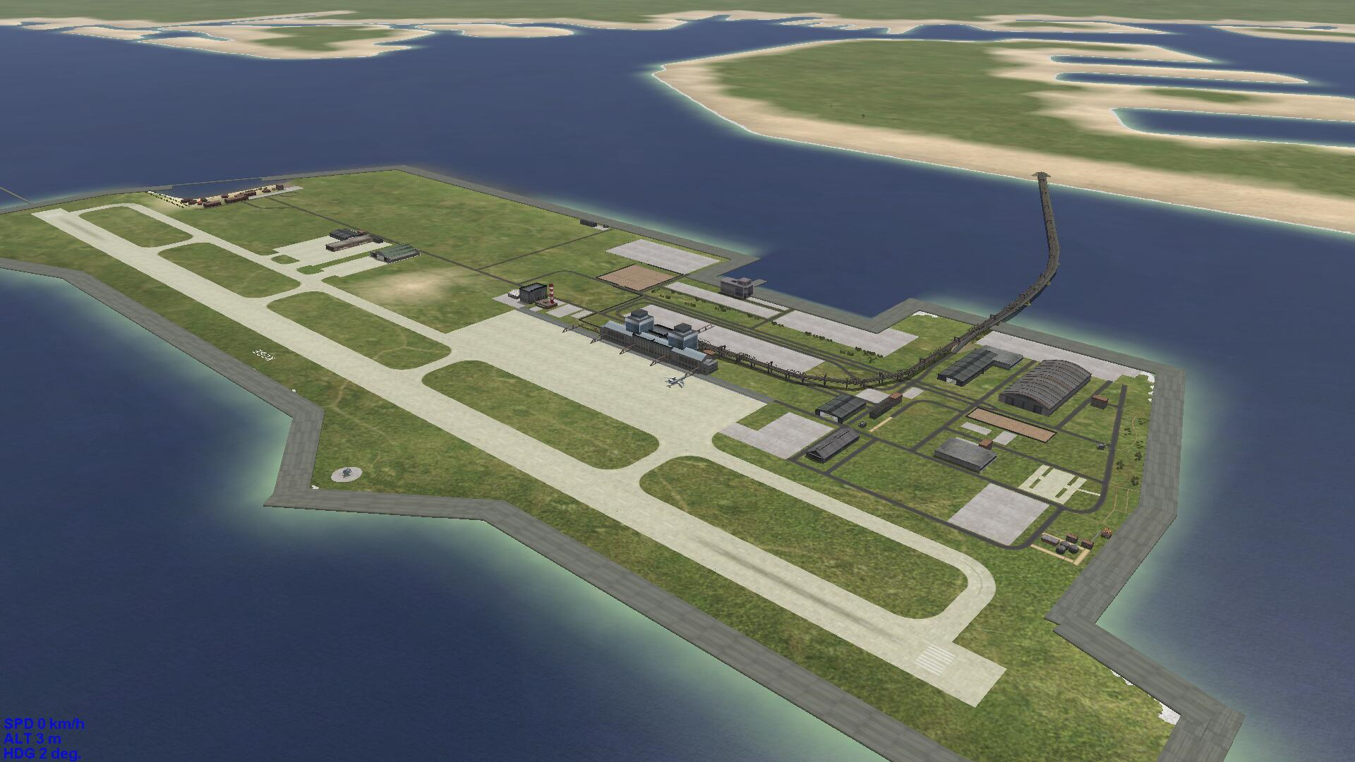
This is the famous KXI Kansai International Airport. I studied in Kyoto, and this airport is the airport I have used most (except for PEK in my hometown). It can be said that I have deep feelings for her. There are two runways, one is 3500 meters 06L/24R and the other is 4000 meters 06R/24L. Although the size and passenger flow of this airport are not as large as Tokyo's HND and NRT, it can also be said to be one of the most important airports in Japan.


Main terminal of KXI


"Kansai Airport" railway station, located in the building in the middle, you can drive a jeep and go along the railway to come inside.
Logged

Ju87R

  • member
  • Offline Offline
  • Posts: 45
2nd. part
« Reply #1 on: July 27, 2020, 04:50:27 AM »

Oh there seems to be something wrong with the picture.
I'll try it again.

This is UKB Kobe airport, in the north of KXI. I used Kobe once on a vanilla airlines flight to Fukuoka.
This airport, together with KXI, is one of the "Three airports of Kansai". However, I don't quite understand why it is necessary to build the fourth airport in this area when another Yao airport is in nearby. Instead, Yao airport is idle.

Kyoto Airport
The old IJA's Tachiarai airfield was used as a training army pilots before the end of World War II. And it was dismantled after the war.
However, it is preserved in this map, and the original 1500m main runway 13/31 is extended to 1800m for using larger jets.
In addition, I cancelled the short runway 06/24. First, it was too short, only 1200m, and the available aircraft types were too limited. Secondly, for an airport with out so many flights, it is not necessary to keep the second runway. But in the game, you can still land on it as an ordinary runway, as long as you are not flying some big things like 707.
In addition, a small civil terminal (2 gates) is set at the end of runway 13. When I study in Kyoto, if I want to fly, I need to spend 2000JPN and 3 hours to go to KXI!!! It's a waste of time. So I want to keep an airport for Kyoto on my map.
Logged

Ju87R

  • member
  • Offline Offline
  • Posts: 45
3rd. part
« Reply #2 on: July 27, 2020, 05:01:29 AM »

Nijō Castle (Kyoto)
You can try something like L5, fi156, or C172 to land on the small road.


Kyoto Imperial Garden.
The longest road is about 1050m, B707 can barely stop with the parachute opened, but it is very dangerous.
Besides, there are many trees and buildings on both sides. If you want to land, you must aim at the runway strictly


Chikubu island on Lake Biwa
The scenery is very beautiful. If you go to Japan in the future, you have to go there.
Logged

Ju87R

  • member
  • Offline Offline
  • Posts: 45
4th
« Reply #3 on: July 27, 2020, 05:14:13 AM »

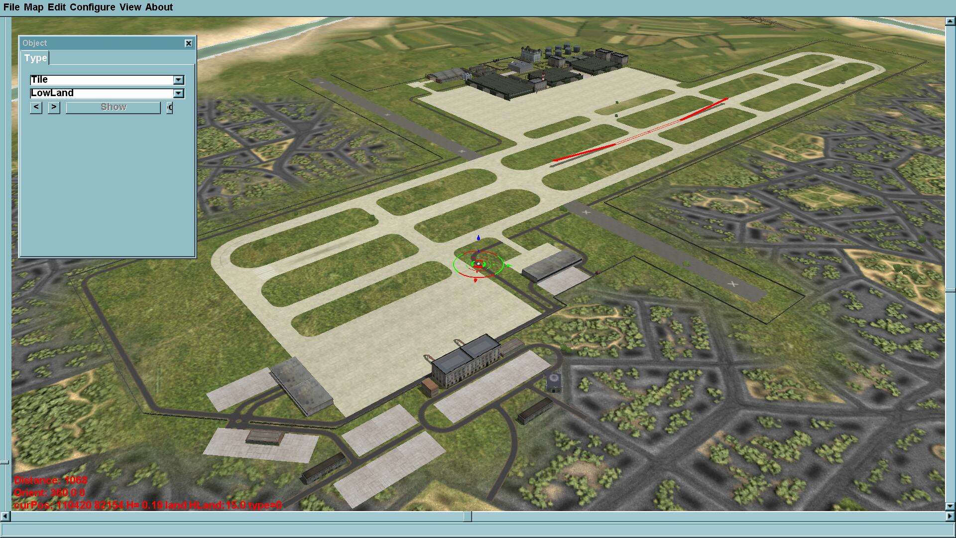
Kakogawa Base
It's also an airport that was demolished after WWII
Originally, there was only a triangular part in the middle (the red part in the final picture), so it is also called a triangular airfield. This time, I extended the main runway to 1800m and set up taxiways on the both sides. The original two shorter runways (01/19 and 13/31) were converted into part of the taxiway.
JASDFs bases were set up in the South and north of the airport. In the west, there is a small terminal (3 gates).
During the construction of the base, I refer to Hyakuri Airbasease, Nyutabar Airbase, and Tokushima Airbase (these three airports will not appear in this map)


Logged

Geschirr

  • member
  • Offline Offline
  • Posts: 834
  • "A plan is a list of things that won't happen."
Re: Central of Honshu 2017(Keihanshin megalopolis)
« Reply #4 on: July 27, 2020, 06:51:59 AM »

You are making dreams come true that I didnt even know I had.
Looks! Amay! Zing!!!
Logged
"If we don't know what we're doing, neither will the enemy."

urmel

  • member
  • Offline Offline
  • Posts: 827
Re: Central of Honshu 2017(Keihanshin megalopolis)
« Reply #5 on: July 27, 2020, 07:13:22 AM »

It looks very good!
Logged

Knochenlutscher

  • Flying Ass Clown #10
  • Modder
  • member
  • Offline Offline
  • Posts: 4593
  • aka Segfej
Re: Central of Honshu 2017(Keihanshin megalopolis)
« Reply #6 on: July 27, 2020, 07:58:09 AM »

Yeah, mainland Japan,

Sumi masen, this is awesome, will travel this Map when ready.
I like that.

Cheers
Tobias

Logged
Wiseman : "Did you speak the exact words?" Ash : "Look, maybe I didn't say every single little tiny syllable, no. But basically I said them, yeah."

csvousden

  • member
  • Offline Offline
  • Posts: 542
Re: Central of Honshu 2017(Keihanshin megalopolis)
« Reply #7 on: July 27, 2020, 08:22:40 AM »

Looking brilliant!
Logged

western0221

  • Modder
  • member
  • Offline Offline
  • Posts: 6790
  • Live in Japan
    • IL-2 itaki blog
Re: Central of Honshu 2017(Keihanshin megalopolis)
« Reply #8 on: July 27, 2020, 10:05:54 AM »

WooooW! Very interesting map project!


I'm also interested in future developing plan how about adding Chu^bu region's (Aichi pref. / Gifu pref.) three airports / airfields on your wip map.


1. Chubu Centrair International Airport (NGO / RJGG)
1x 3,500 meters runway.
An artificial island similar to KIX / RJBB and UKB / RJBE you built.

2. Nagoya Airfield / JASDF Komaki Airbase (NKM / RJNA)
1x 2,740 meters runway.
It was an International airport until Centrair opened in 2005.
JASDF operates C-130 and KC-767 here.
Neighboring Mitsubishi Heavy Industries' factory --- build or maintenance of F-1 / F-2 / F-15J / F-35A.

3. JASDF Gifu Airbase (QGU / RJNG)
1x 2,710 meters runway.
JASDF's Air Development and Test Wing is placed here.
Neighboring Kawasaki Heavy Industries' factory --- build or maintenance of C-2 / P-1.
It was IJA's Kagamigahara Airbase in WWII time and many Japanese-made airplanes' First-Flight was done like A5M / A6M / Ki-61's prototypes.
Logged

Ju87R

  • member
  • Offline Offline
  • Posts: 45
Re: Central of Honshu 2017(Keihanshin megalopolis)
« Reply #9 on: July 27, 2020, 12:38:49 PM »

WooooW! Very interesting map project!


I'm also interested in future developing plan how about adding Chu^bu region's (Aichi pref. / Gifu pref.) three airports / airfields on your wip map.

Of course I'll make them. But now I'm still working on a couple of airports in the West. It includes Itami, Yao, Tajima, and aebano. And some old airports that didn't exist, such as Karasu, Iga, and Kokawa. I plan to build these airports from west to East.
Logged

Ju87R

  • member
  • Offline Offline
  • Posts: 45
Re: Central of Honshu 2017(Keihanshin megalopolis)
« Reply #10 on: August 08, 2020, 10:56:49 PM »

Some new airfiled
They are:
Tajima Airport, A local airport for regional aircraft. The airport is located at the top of the mountain, which is challenging to take off and land.
Maishima Airfield, A small airport now abandoned. In the map, I made it as it in today. But I still put a take-off point on it, where you can try to take off and land on some small planes.
Yura airfield and Kokawa airfield, they are Military airfields in World War II. I kept them in the map. To avoid the lack of airports in these areas.


Screenshot of the whole Maishima island.
In order to apply for the 2008 Olympic, Maishima was designated as a sports venue area. As a result, the small airport with a 700m runway was cancelled and converted to its present form (although Osaka didn't got the 2008 Olympic). Now the runway has been shortened to 500m and appears to be used as a venue for car sports. After that, the Osaka government built an Maishima heliport on the east side of Maishima Island, which I also put it on this map.


Maishima and Yumeshima

Logged

pilotpimpf

  • member
  • Offline Offline
  • Posts: 233
Re: Central of Honshu 2017(Keihanshin megalopolis)
« Reply #11 on: August 09, 2020, 03:21:38 AM »

The details are incredible, fantastic work, thank you

Look forward to flying this one
Logged
Pages: [1] 2 3 4 5   Go Up
 

Page created in 0.039 seconds with 25 queries.