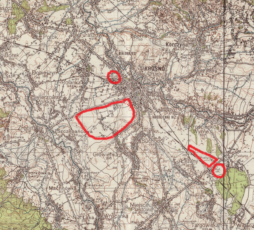
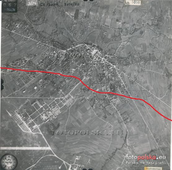
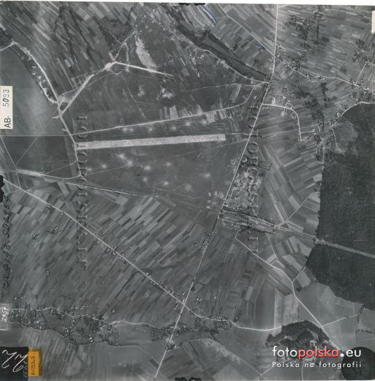
Based on the readings from the map and the route of the railway and after comparing them with aerial photographs from 1944 I marked more or less the shape of the Krosno airfield and the reserve airfield in Łęzany, and the location of the refineries in Krosno and Łężany with a red circle:

Krosno 1944:

Airfield Krosno-Iwonicz (POL) (a.k.a. Krosno-Łęzany):

Krosno-Iwonicz (POL) (a.k.a. Krosno-Łęzany) (49 39 40 N – 21 49 30 E)
General: landing ground in S Poland 170 km SE of Kraków and 5 km SE of Krosno.
History: built 1937-38 and used as a satellite of Krosno (Altkirch). Surface and
Dimensions: grass surface measuring approx. 1190 x 730 meters (1300 x800 yards). The
1190 meter (1300 yard) runway (paved?) was aligned NW/SE. Infrastructure: limited
facilities but had dispersal areas for aircraft.
Remarks:
26 Aug 44: mines had been detonated on the landing area by this date rendering it
unserviceable.
Operational Units: III./KG 51 (Jun-Jul 41); Stab, III./SG 10 (Jul 44).
Station Commands: Fl.H.Kdtr. E 10/VI (Mar 44)?; Fl.H.Kdtr. E(v) 208/VIII Krosno-Lezany
(Apr-Sep 44).
Station Units (on various dates – not complete): none identified.
[Sources: AFHRA A5263 p.1110 (31 Dec 43 updated to 26 Aug 44); chronologies; BA-MA;
NARA; PRO/NA; web site ww2.dk]
As for the hills in my area (Beskid Niski) they are 500-600 to 700 metres each.
 Author
Topic: Location of Uzhgorod AF during WWII ? (Read 1244 times)


