My Hungarian Grandpa fought there
The area was not totally flat.
Can't tell about the exact geographical formations.
https://data.maptiler.com/downloads/dataset/terrain-rgb/#8.12/51.08/39.48
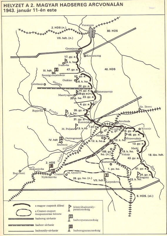
Korotoyak at the hungarian center Sector IV. Hadtest
If you ever came across Wartime pictures of the hungarian Front you'll see sth. special
for the Region. Allocated at IV.Hadtest Frontline between Korotyak and Sztorozsejevo, and further down into the Italian Army sector until Pawlosk.
In general these chalk Formations spread on the Western bank until Serafimovitcs, the Romanian Sector.
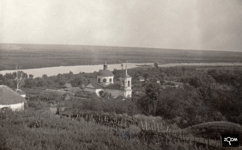
Chalk Hills on the Western Bank of Don. Strange geological hills, slopes. High enough for a Ju88 flying underneath the top sides.
The Eastern banks of these formations in summer where rowed with flame throwers.

The Hungarian Artillery took camp there, and the units just loved this tiny geographical glitch in the repeated flat emptiness.
These Chalk formations you can trace in Hungarian army pictures dating Summer 1942, foxholes, trenches, artillery dugged on top of such strange
formations. But not just that, the Hungarians even drilled Bunker, Housing into the Western side of such Hills, which gave them some better comfort
than the plain soil.
this how the sector looked in strange contrast to the flat being

overlooking Rudkino

modern day landscape of the Hungarian Front sector
https://www.youtube.com/watch?v=S784PQ8Z2RQat 16:00 - 17: you'll trace the varying landscape of the south of Woronesh Don
https://www.youtube.com/watch?app=desktop&v=dHDEO2TTnuQ


 Author
Topic: Map of Voronezh area (Read 3518 times)


